


-

"Very nice Posters. The quality is amazing and we received it very quickly !"
-

"A shop to visit absolutely. Huge selection of posters. We spent more than an hour there !"
-

"Perfect to find gift. Price are very good. An they can frame and pack it on site"


About the Artist
Bartholomew John George was part of the distinguished British cartographic tradition in the early twentieth century, a period when mapmakers combined scholarly precision with advances in printing and accessibility. Working during a time of expanding railways and growing literacy, George and his contemporaries produced maps designed for both practical reference and educational use. His work reflects an era when geography was central to daily life, serving travelers, students, and professionals alike.
This map stands as a testament to the importance of clear, reliable cartography in an age before digital navigation, offering insight into how people understood and navigated the world around them.
The Artwork
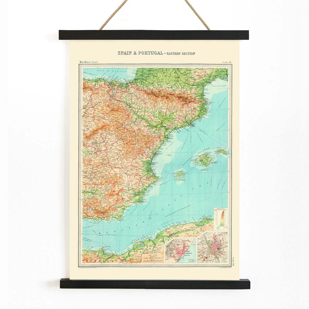
Published in 1922, this map of Spain and Portugal presents the Iberian Peninsula as seen through the lens of British cartography. Created for English-speaking audiences, it was intended as a reference tool for classrooms, libraries, and travelers. In the aftermath of World War I, such maps symbolized stability, knowledge, and a renewed curiosity about international connections. The piece captures a historical moment when printed maps were essential guides to understanding foreign lands and their relationships.
For those interested in vintage map wall art, it provides a fascinating glimpse into early twentieth-century perspectives on European geography, and pairs well with other blue tone posters for a cohesive display.
Style & Characteristics
The map is rendered in the style of a classic atlas plate, with precise black typography, fine boundary lines, and a clear visual hierarchy. The palette features soft blue for the surrounding seas, warm beige for the land, and subtle green and orange accents to distinguish terrain and administrative divisions. The composition is orderly and informative, prioritizing legibility and clarity over decorative flourishes. This restrained aesthetic lends the piece a timeless, scholarly appeal.
Its understated colors and balanced design allow it to complement beige wall art and other neutral-toned decor, making it versatile for a range of interiors.
In Interior Design
This Spain and Portugal map print is well suited to studies, offices, hallways, or living rooms where a sense of order and worldly curiosity is desired. It harmonizes with modern, Scandinavian, and classic interiors, especially when paired with oak, walnut, or black metal accents. To echo the map's palette, consider blue textiles, green plants, and terracotta or muted orange ceramics.
For a polished presentation, frame it with options from the frames collection, creating a refined focal point for travel enthusiasts and design lovers alike.