


-

"Very nice Posters. The quality is amazing and we received it very quickly !"
-

"A shop to visit absolutely. Huge selection of posters. We spent more than an hour there !"
-

"Perfect to find gift. Price are very good. An they can frame and pack it on site"


About the Artist
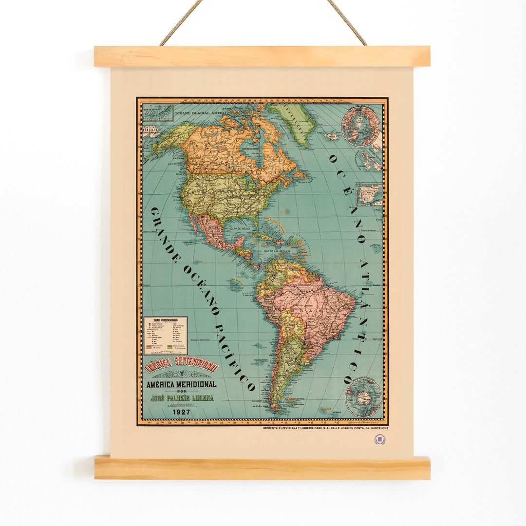
Josep Paluzie Lucena was a Spanish cartographer and publisher who played a significant role in the flourishing print culture of late 19th-century Barcelona. His maps were valued not only for their accuracy but also for their ability to make geography accessible and engaging to a broad audience. Paluzie Lucena’s work reflects a period when understanding geography and world affairs became increasingly important in education and daily life.
His contributions helped shape how people in Spain and beyond visualized distant lands, supporting both learning and curiosity in an era of exploration and modernization.
The Artwork
Created in 1899, this map of the Americas embodies the spirit of educational cartography at the turn of the century. At a time when printed maps were essential reference tools, this piece offered Spanish-speaking viewers a window onto the continents, their borders, and their place in a rapidly globalizing world. Such maps were often displayed in classrooms and homes, symbolizing both knowledge and progress.
The artwork invites viewers to consider how the Americas were understood and represented in a period marked by expanding communication and trade across the Atlantic.
Style & Characteristics
This disciplined cartographic plate features meticulous boundary lines, dense but legible typography, and a harmonious, ordered layout. The seas are rendered in cool blue tones, while the landmasses rest on a warm beige background, lending the map a gently aged, archival quality.
Subtle greens and touches of orange highlight specific regions and details, guiding the eye without detracting from the clarity of information. The overall mood is scholarly and nostalgic, making it a refined example of vintage mapmaking with enduring visual appeal.
In Interior Design
This vintage map print lends sophistication to a home office, library, hallway, or living room, especially where thoughtful decor is desired. It pairs well with wood, leather, brass, and linen, and can serve as a historical accent in modern interiors.
For a cohesive gallery wall, combine it with other map wall art, or echo its palette with blue tone posters and beige wall decor for a calm, curated atmosphere.