


-

"Very nice Posters. The quality is amazing and we received it very quickly !"
-

"A shop to visit absolutely. Huge selection of posters. We spent more than an hour there !"
-

"Perfect to find gift. Price are very good. An they can frame and pack it on site"


About the Artist
James Reynolds was a mid-19th century cartographer known for his educational maps that made complex scientific knowledge accessible to a broad audience. His work emerged during a period when public interest in geography and the natural sciences was growing rapidly, fueled by industrial progress and global exploration. Reynolds contributed to the popularization of scientific cartography, helping to bridge the gap between academic research and everyday curiosity.
His maps, often found in schools and private libraries, were valued not only for their accuracy but also for their decorative appeal, reflecting the Victorian era’s fascination with both learning and aesthetics.
The Artwork
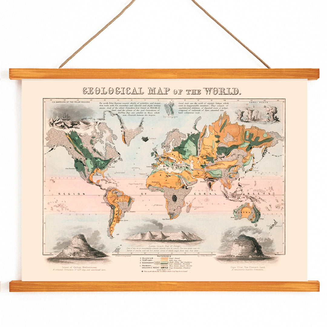
This 1850 Geological map of the world was created at a time when geology was becoming a prominent science, essential to the progress of mining, engineering, and railway expansion. The map served as a tool for visualizing the Earth’s layers and geological formations on a global scale, making scientific concepts tangible for the general public. It stands as a historical document of how knowledge about the planet’s structure was organized and disseminated during the Industrial Revolution.
Collectors of science-themed prints and enthusiasts of classic cartography will appreciate its role in the evolution of educational wall art, as well as its insight into 19th-century scientific communication.
Style & Characteristics
The map features finely rendered coastlines, dense labeling of place names, and a clear legend that links regions to geological categories. Its crisp linework and precise typography evoke the encyclopedic style of Victorian atlas plates. The background is a warm beige, overlaid with soft yet distinct color fields in green, orange, pink, and muted grey, each representing different geological strata.
This careful use of color creates a harmonious yet informative visual rhythm, while the overall mood remains scholarly and quietly adventurous. The piece exemplifies the blend of scientific rigor and decorative elegance that defines 19th-century map art, making it a standout in any map art print collection.
In Interior Design
This geological vintage print enhances spaces like home offices, libraries, or living rooms where detailed, conversation-worthy artwork is desired. It pairs well with wood, leather, and black metal accents, complementing both academic and industrial-inspired interiors.
To echo the map’s palette, consider linen textiles for warmth and introduce green or orange accents through ceramics or cushions. It also serves as a striking anchor for a gallery wall of framed vintage prints, appealing to travelers, science enthusiasts, and design-minded collectors.