


-

"Very nice Posters. The quality is amazing and we received it very quickly !"
-

"A shop to visit absolutely. Huge selection of posters. We spent more than an hour there !"
-

"Perfect to find gift. Price are very good. An they can frame and pack it on site"


About the Artist
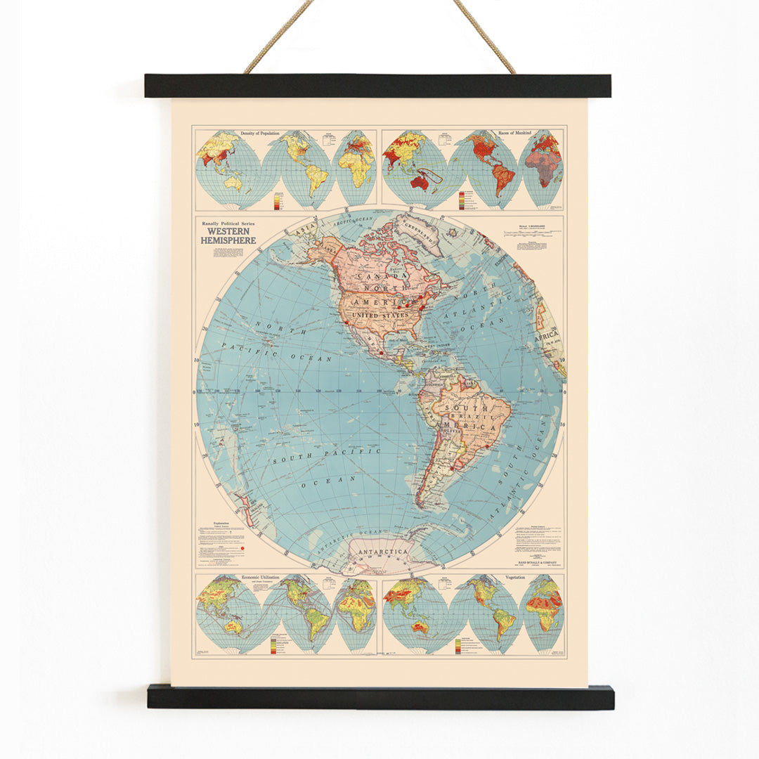
Rand McNally and Co was a leading American map publisher, renowned for shaping public understanding of geography through atlases, classroom charts, and reference maps. Based in Chicago, the company established a reputation for accuracy and clarity, making their maps a staple in schools and homes across the United States. Their work reflects a commitment to accessible, reliable cartographic information during a time of rapid global change.
This 1940 map poster exemplifies Rand McNally's dedication to educational resources and practical design. For those interested in map posters, it offers a historical perspective on how the Americas were depicted during a period marked by shifting international dynamics and technological advancements in travel.
The Artwork
Created at the dawn of World War II, this Western Hemisphere map was designed to orient viewers to the interconnectedness of the Americas. As global events unfolded, such maps became essential tools for understanding new routes, alliances, and the significance of geography in world affairs. The map served as a reference in classrooms and offices, encouraging a broader awareness of the Western Hemisphere's role in contemporary history.
Its presence in educational and professional settings highlights the importance placed on geographic literacy and the visualization of distant places. The map's creation reflects a moment when understanding the world—and one's place within it—was more vital than ever.
Style & Characteristics
The map features a balanced composition with clearly defined coastlines, precise latitude and longitude grids, and legible labeling. Cool blue tones dominate the oceans, contrasted by warm, parchment-like landmasses that evoke a sense of archival authenticity. Borders and names are rendered with careful, understated typography, typical of mid-century cartographic style.
Small details such as compass roses and scale bars add to its functional charm. The overall effect is calm and orderly, making it an appealing choice for those who appreciate vintage cartography or are curating a collection of blue wall art.
In Interior Design
This map poster brings a thoughtful, scholarly touch to home offices, libraries, or living rooms. Its neutral palette and classic design pair well with mid-century furnishings, natural woods, and navy or beige accents. It also suits a teen's study space, sparking curiosity about geography and history.
For a refined look, consider framing it from the frames collection. The map's timeless style integrates seamlessly into gallery walls that mix travel, history, and design themes.